Using Satellite Data to Fill the Gaps in the US Air Pollution Monitoring Network
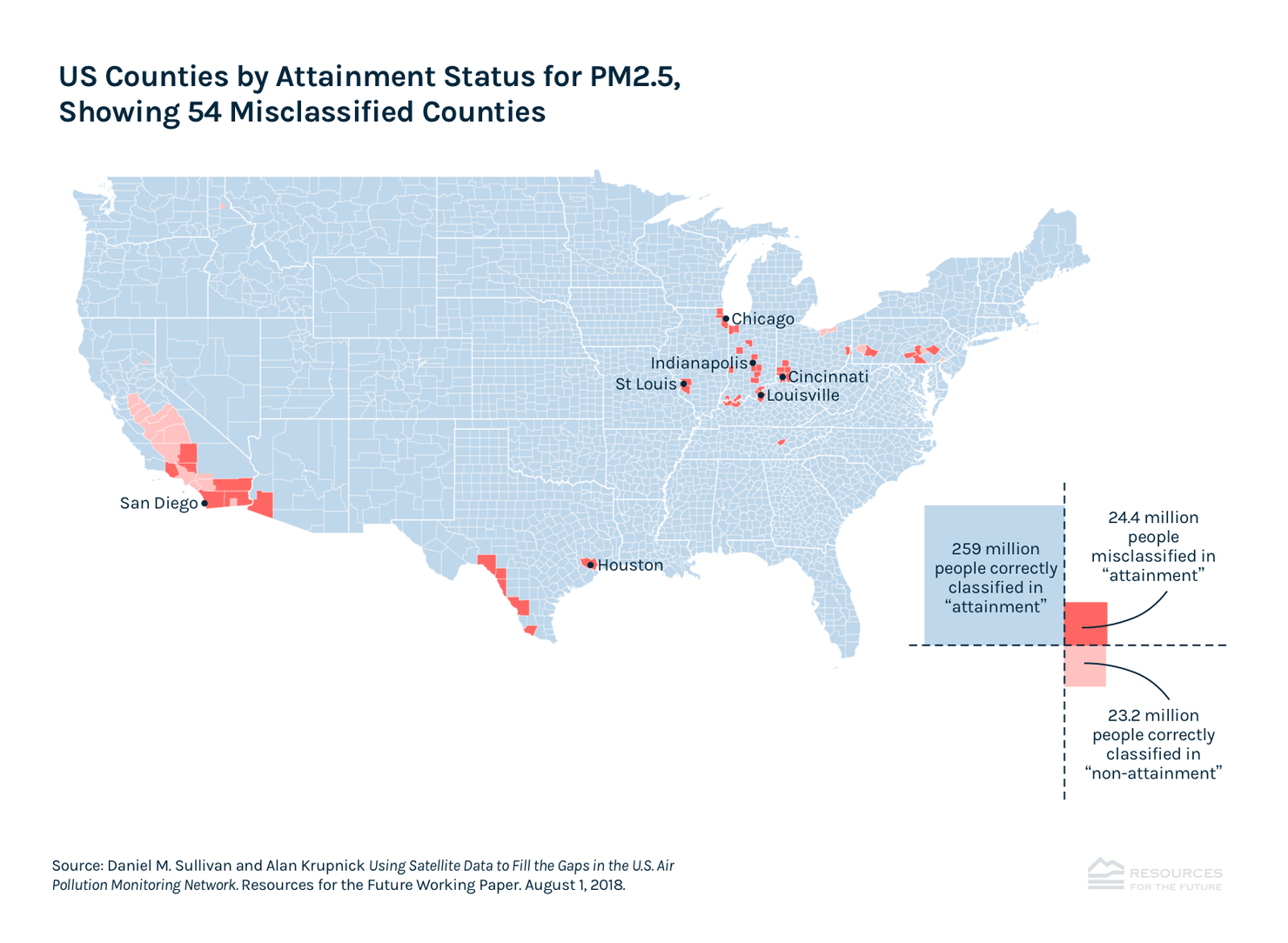
This paper uses new satellite data to assess fine particulate matter concentrations and finds that 24.4 million more Americans than previously thought live in counties that do not meet the annual health standard set under the Clean Air Act.
Compliance with the Clean Air Act’s National Ambient Air Quality Standards (NAAQS) is determined at the county level using local air pollution monitors. However, the vast majority of counties have zero or one monitor, and air pollution concentrations can vary dramatically over short distances. In addition, recent evidence suggests monitor placement may be skewed to make NAAQS compliance easier. As a result, the network of air pollution monitors may not detect all areas with pollution levels that exceed the NAAQS. This paper explores this possibility using satellite data on fine particulate matter concentrations (PM2.5) to assess NAAQS compliance for the continental United States at a 1 kilometer (km) resolution. We compare the satellite-based assessments with official attainment designations made by the terrestrial monitor network and calculate the number of people living in “misclassified” areas—areas with PM2.5 levels that exceed the NAAQS but are classified as being in attainment based on the ground monitors and the US Environmental Protection Agency’s (EPA’s) official determination. We estimate that about 24.4 million people are living in these misclassified areas—about as many as are living in properly classified nonattainment areas—and that if such areas had sped up their PM2.5 reductions as much as nonattainment areas did, 5,452 premature deaths would have been avoided, a welfare gain to society of $49 billion.